|
| |
 The
Great Western Trail (GWT) is actually much more than a trail,
but rather a corridor of trails and passageways designed to serve the
many types of trail interests and users. Using whatever was available,
travelers in the Old West made their way by foot or horseback, or by
using a variety of vehicles including wagons and water craft as they
moved between communities, over mountain passes, down rivers, and across
valleys. And so it is today along the Great Western Trail as the magic
and romance of the Old West unfolds once more to recreational enthusiasts
from across the nation and many foreign countries. Opportunities exist
for hikers, horseback riders, boaters, mountain bikers, cross-country
skiers, and off-road vehicle and snowmobile riders to traverse this
scenic and culturally rich area of our nation in a variety of ways. The
Great Western Trail (GWT) is actually much more than a trail,
but rather a corridor of trails and passageways designed to serve the
many types of trail interests and users. Using whatever was available,
travelers in the Old West made their way by foot or horseback, or by
using a variety of vehicles including wagons and water craft as they
moved between communities, over mountain passes, down rivers, and across
valleys. And so it is today along the Great Western Trail as the magic
and romance of the Old West unfolds once more to recreational enthusiasts
from across the nation and many foreign countries. Opportunities exist
for hikers, horseback riders, boaters, mountain bikers, cross-country
skiers, and off-road vehicle and snowmobile riders to traverse this
scenic and culturally rich area of our nation in a variety of ways.
It is envisioned as a north/south trail system extending from Canada
to Mexico. A route is possible and actually in place through much of
the area. The route being chosen for this trail corridor and at least
one tread alignment takes advantage of the rich abundance of public
lands throughout the heart of the Rockies. By following mostly existing
roads and trails, very little right-of-way acquisition and minimal new
construction is needed. This trail would be mostly on National Forests
and some public domain administered by the Bureau of Land Management
in Idaho, Wyoming, Utah, and Arizona.
 The
preferred route from north to south would include the Idaho Centennial
Trail route to the Magruder Corridor (Idaho Panhandle National Forest
(NF), Clearwater NF, & Nez Perce NF), then east between the Selway Bitterroot
and Frank Church River of No Return Wilderness areas (Bitterroot NF
and Salmon NF). An additional alternate southern route floatable by
permitted water craft along the historic main Salmon River east/west
through Idaho is possible (Clearwater NF & Salmon NF). Once at the ldaho\Montana
border the GWT corridor then extends south along the alignment of the
existing Continental Divide National Scenic Trail to the Trail Pass
(Salmon NF & Beaverhead NF), then south through the Targhee NF past
the west side of Yellowstone NP to Palisades Reservoir, where the route
splits. An additional alternate route is being considered for pedestrian
and horse access across the southwest corner of Yellowstone NP. From
there it continues south in Idaho through the Caribou NF near Soda Springs,
and Montpelier to the Utah border west of Bear Lake. Again at the Palisades
Reservoir, the trail splits and extends along the east side of the reservoir
to Alpine, Wyoming, then south along the Greys River to La Barge and
Smith Fork, then northwest into Star Valley, Wyoming (BridgerfTeton
NF), then west into Idaho past Montpelier, connecting again on the.
ridge west of Bear Lake (Caribou NF). At the Utah border, the trail
corridor continues south east of Logan, Salt Lake City, Provo, Nephi,
and several smaller communities along the Wasatch Front, extending into
southern Utah (Wasatch/Cache NF, Uinta NF, Manti NF, Fishlake NF, and
Dixie NF). At the southern Utah border, the GWT corridor could extend
through Arizona completing the link to the border of Mexico.' This extension
could follow a proposed motorized trail route and be known as the El
Camino Grande section of the GWT. This section would extend south and
east through Arizona crossing the Colorado River upstream of the Grand
Canyon NP and head south passing Flagstaff, Phoenix, and Tucson finally
reaching the border of Mexico. (Kiabab NF, Coconino NF, Tonto NF, and
Coronado NF) The
preferred route from north to south would include the Idaho Centennial
Trail route to the Magruder Corridor (Idaho Panhandle National Forest
(NF), Clearwater NF, & Nez Perce NF), then east between the Selway Bitterroot
and Frank Church River of No Return Wilderness areas (Bitterroot NF
and Salmon NF). An additional alternate southern route floatable by
permitted water craft along the historic main Salmon River east/west
through Idaho is possible (Clearwater NF & Salmon NF). Once at the ldaho\Montana
border the GWT corridor then extends south along the alignment of the
existing Continental Divide National Scenic Trail to the Trail Pass
(Salmon NF & Beaverhead NF), then south through the Targhee NF past
the west side of Yellowstone NP to Palisades Reservoir, where the route
splits. An additional alternate route is being considered for pedestrian
and horse access across the southwest corner of Yellowstone NP. From
there it continues south in Idaho through the Caribou NF near Soda Springs,
and Montpelier to the Utah border west of Bear Lake. Again at the Palisades
Reservoir, the trail splits and extends along the east side of the reservoir
to Alpine, Wyoming, then south along the Greys River to La Barge and
Smith Fork, then northwest into Star Valley, Wyoming (BridgerfTeton
NF), then west into Idaho past Montpelier, connecting again on the.
ridge west of Bear Lake (Caribou NF). At the Utah border, the trail
corridor continues south east of Logan, Salt Lake City, Provo, Nephi,
and several smaller communities along the Wasatch Front, extending into
southern Utah (Wasatch/Cache NF, Uinta NF, Manti NF, Fishlake NF, and
Dixie NF). At the southern Utah border, the GWT corridor could extend
through Arizona completing the link to the border of Mexico.' This extension
could follow a proposed motorized trail route and be known as the El
Camino Grande section of the GWT. This section would extend south and
east through Arizona crossing the Colorado River upstream of the Grand
Canyon NP and head south passing Flagstaff, Phoenix, and Tucson finally
reaching the border of Mexico. (Kiabab NF, Coconino NF, Tonto NF, and
Coronado NF)
STATE VOLUNTEER COORDINATORS
Idaho & Wyoming
Chuck Christensen
Rt. 1 Box 3490
Driggs, ID 83422
Utah
Monroe Gallier
1272 South State
Provo, UT 84601
(801) 373-6880
Hugh Jacobs
232 East 140 North
Lindon, UT 84042
(801) 785-8781
Arizona
Arizona State Association
of 4-Wlheel Drive Clubs, Inc.
ASA4WDC
GARY KELLER - Land Use Chairman
Member of Off Highway Vehicle Advisory Group OHVAG
531 N. Los Acamos
Mesa. AZ 85213
(H) 602-832-1495 (W) 602-870-5413
|
|
|
| |
 |
|
|
| |
|
|
| |
 |
|
| |
 |
|
| |
 |
|
| |
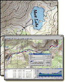
NEW "Paiute
ATV Trail Guide Book". Page
after page of detailed information on the Paiute
ATV Trails. Photos, Maps, GPS Data for every
intersection and point of interest on the trail,
Tip and Tricks for riding the Paiute ATV Trails.
Click Here for More details. |
|
|
|
 |
|
|
|
 |
|
| |
|
|
|
|
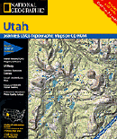
Trails Illustrated topographic maps are designed
to take you into the wilderness and back.
Printed on durable tear-resistant, waterproof
material, this map can go virtually anywhere you
do!
Click here for details. |
|
| |
|
|
|
|
Sponsors
Needed |
|
|
|
Your Ad
Can Go Here! |
|
|
|
Contact Us
Click Here
to request
Details. |
|
|
|
Multiple
Website
Advertising
Special. |
|
|
|
Buy 1 Banner
and |
|
|
|
Get Advertising
on Multiple Websites.
for one low single
ad price. |
|
|
|
| |
|