Utah
Page six
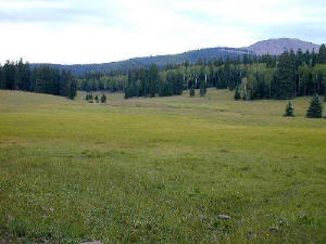 The stuff dreams are made of - I love to imagine my house right here, with
this the view from my front window. This land is pristine. There were quite
a few deer and a lot of range cattle about, there is one in this photo way
off in the distance looking back at me. There were many meadows such as
this in the high country. It was sometimes rather surprising; you would
be riding through endless forest and then burst out into a beautiful meadow
that seemed nearly as big. Here it's overcast, but again - I never got rained
on.
The stuff dreams are made of - I love to imagine my house right here, with
this the view from my front window. This land is pristine. There were quite
a few deer and a lot of range cattle about, there is one in this photo way
off in the distance looking back at me. There were many meadows such as
this in the high country. It was sometimes rather surprising; you would
be riding through endless forest and then burst out into a beautiful meadow
that seemed nearly as big. Here it's overcast, but again - I never got rained
on.
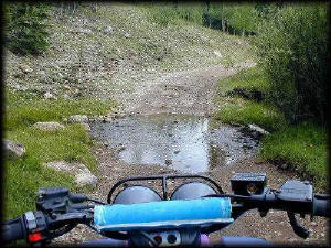
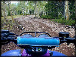
The "in-quad cam"! I crept through the
streams. I hate fording water, and luckily most of the streams were pretty
tame so I had no problem going through them. Some of the bigger streams
had fishermen along the sides of them, though I know not what they were
fishing for. Much planning appears to have gone into the placing of the
ATV trails since you rarely had to go through anything much bigger than
this. The bigger creeks you rode along the side of until a safe passage
or a bridge occurred.
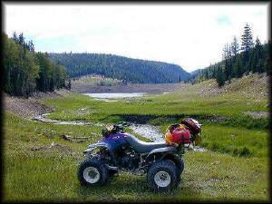
Here is a large reservoir, somewhere near
the gravel Hwy 153. There were quite a few RV's and campers in this area.
In the Fishlake National Forest, you can park and camp anywhere (and a lot
of folks do), as long as you don't stay in the same place for more than
14 days. Often I would be cruising along on some old timber trail and find
a hunters trailer or camper parked in the woods at the side of the road.
Some of the roads were so bad the trailers couldn't possibly come out without
a lot of work, but many bore evidence of having a truck or something come
in and move them to the other side of the meadow just so the rangers wouldn't
cite them for being in the same place for two weeks. Most of the camps were
empty, but sometimes somebody would give me a wave as I passed by.
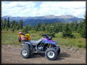
Oh to have my house right here! - What
a view!
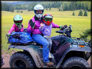
I was riding down the trail and this guy comes
into view around a corner. I stopped and chatted with him a bit. He and
his daughters were just enjoying the day. I got the impression they were
staying not far away at what was a ski lodge during the winter of which
there are quite a few around, though the Paiute ATV trail steers clear of
most places of inhabitation. The Paiute seems instead to traverse desolate
areas in between the towns of Circleville and Marysvale, which was fine
with me. I asked them to wave at the "folks back home" who were missing
this, and they happily did so. And might I point out, if you did this in
California and a ranger caught you, good luck trying to explain it. All
the Rangers I met here in the Fishlake seemed little concerned with such
things as helmets (quite a few riders were not wearing them), whips, or
stickers. They were VERY concerned with people who behaved like idiots and
endangered themselves or others on the trail, and a couple had stories to
tell of such things. Happily, everybody I met on the trail or back in camp
were there to enjoy the sights and trail-ride, not race through the forest
with their hair on fire at top speed.
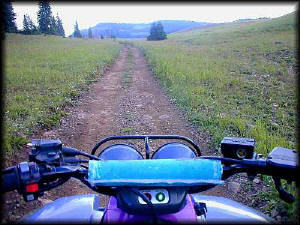
Many of the trails were like this; quad
sized and nearly endless. This one ran for miles through thick forests and
lush, green meadows. I saw a few deer, and possibly even an Elk or two,
but they moved well away from me before I could get close. Which isn't surprising
since the Supertrapp exhaust pretty much insures that most creatures could
hear me an hour before I arrived (I may be slow, but by goodness, you will
know that I'm on the way!).
I carried two two-gallon gas cans, which were
totally unnecessary since I got terrific gas mileage. I estimated an unbelievable
90 miles on a tank of gas for the Warrior, which was almost an all day ride
(with stops of course). Besides food, water, matches, rain gear, and a minimal
tool kit, I carry the "worm" type tubeless tire plugs, and a dozen C02 cartridges,
which fit into a handheld tire inflator. I used it once on the trail, and
two CO2 cartridges brought the tire up to several pounds. The whole down
time with the flat was less than ten minutes. I also got several "slow leakers"
that necessitated me using a cartridge to bring the tire up equal to the
other on the trail, but the repairs waited until I got back to camp where
I could find the leaks.
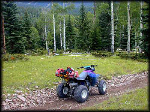
Many of the trails are "quad sized" and you
do not share the road with anybody on foot, horseback, or 4wd. I did meet
a lot of "groups" of ATV riders who were riding together. Some were surprised
that I was by myself. I did worry about breakdown, or worse yet an injury,
but I figured if worst came to worst I could set the gas tank on fire and
gnaw on the tires until help arrived if I got stranded. (You know, kinda
like shooting your horse to survive.) Okay, maybe I didn't really
think this would work, but hey, it sounded good. I carried a ham radio,
GPS, and cell phone (which worked pretty well in the high country). There
were also a lot of hunters campers and RV's stashed about the forest in
odd places, and I always tried to keep a mental note of where the last one
was I saw.
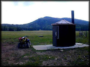
So I'm cruising down the high-country
trail, in the middle of nowhere in particular, and I spy this thing at the
edge of a meadow. As I approach I'm wondering what it is- it can't be! Yep,
it is! A crapper in the middle of nowhere! Now why, of all places, did the
State of Utah put this here? I found a trail that came in from another direction
that appeared to be the access for the pump truck, but why here? I just
shook my head and took a break since, well, that was what it was there for.
(It was cleaner than any Shell restroom I've ever been in! Not that I'm
the connoisseur of crappers or anything. Okay, time to move on now.)
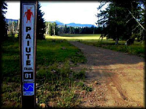
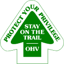
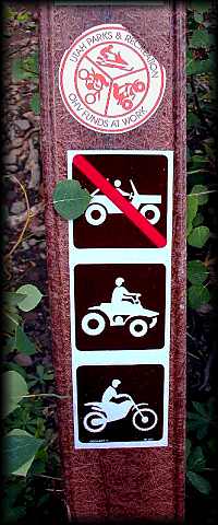
The Paiute has markers like this spread throughout.
They, along with an
excellent map that seemed to be for sale at any place that catered
to ATV enthusiasts, kept you on track and sure of where you were going.
They also frequently had the little blue indicators denoting trail difficulty.
This one says (in blue) "more difficult". This was one of the first few
"blue signs" I saw, and I scoffed at this one. I mean, I can see ahead and
it looks mellow. Who are they putting these signs up for - old ladies? Wrong-o
buddy. Those blue markers were not joking - four miles ahead and this trail
degenerated into the rock-infested steep-switchback trail from hell. Not
too difficult if you crept through it, but it gave me a righteous case of
monkey-butt as I scooched from side to side at every switchback and large
rock due to the angle of the trail. I quickly grew a bit more respect for
the signs.