|
| |
 In
mining communities, it was often the enterprising people of
the time who struck it rich. They became wealthy not by
swinging a pick or hefting a shovel but by providing services
to the miners. Shovels could cost $50 and bartenders often
made hundreds or even thousands of dollars profit on a single
barrel of whiskey. In
mining communities, it was often the enterprising people of
the time who struck it rich. They became wealthy not by
swinging a pick or hefting a shovel but by providing services
to the miners. Shovels could cost $50 and bartenders often
made hundreds or even thousands of dollars profit on a single
barrel of whiskey.
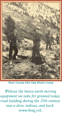
In 1869, several men built the first road into Bullion Canyon
and then set up a toll station. At this time there were
several rich claims being worked in the canyon and it was now
possible to haul ore by wagon.. To the dismay of the toll road
operators, the miners built a second road into the canyon to
avoid paying a toll their teamsters considered unreasonable.
This second road closely follows the same route we drive
today. The remains of the toll road are visible on the
right side of the road (north) and lie 25 feet above this stop.
Look for short, graded sections of roadbed now overgrown with
oak. The course of this old road can be seen from this
spot for a distance of about 150 feet up and down the canyon.
All of these early roads were built by pick, shovel and dynamite.
|
|
Stop 2 is .85 miles past the trailhead
Next Page [ Stop 2
- The Mill Stables ]
|
|
|
| |
|
| |
 |
|
|
| |
|
|
| |
 |
|
| |
 |
|
| |
 |
|
| |
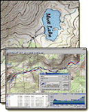
NEW "Paiute
ATV Trail Guide Book". Page
after page of detailed information on the Paiute
ATV Trails. Photos, Maps, GPS Data for every
intersection and point of interest on the trail,
Tip and Tricks for riding the Paiute ATV Trails.
Click Here for More details. |
|
|
|
 |
|
|
|
 |
|
| |
|
|
|
|
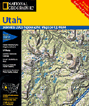
Trails Illustrated topographic maps are designed
to take you into the wilderness and back.
Printed on durable tear-resistant, waterproof
material, this map can go virtually anywhere you
do!
Click here for details. |
|
| |
|
|
|
|
Sponsors
Needed |
|
|
|
Your Ad
Can Go Here! |
|
|
|
Contact Us
Click Here
to request
Details. |
|
|
|
Multiple
Website
Advertising
Special. |
|
|
|
Buy 1 Banner
and |
|
|
|
Get Advertising
on Multiple Websites.
for one low single
ad price. |
|
|
|
| |
|