INTRODUCTION TO THE TRAIL

Welcome to South-Central Utah's 900+ mile long Paiute ATV trail System,
a trail system that has no beginning and no end! It passes through multiple
towns and has side trails leading into others. Dirt Wheels magazine rated
the Paiute ATV Trail as one of the top 10 trail systems in the country.
It has been rated as one of the top 5 trails in the country by ATV Illustrated
magazine. Many riders consider the Paiute Trial to be the TOP US trail system.
This website is intended as a guide to acquaint you with the trail and to
help make your ride an enjoyable event you will long remember. You should
read it before you embark on your journey, so you will know what to expect.
Or better yet buy the book. A
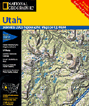
trail map, part of the Utah Map Series published by Trails Illustrated
provides excellent guidance while on the trail.
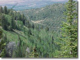
The trail is designed to provide an enjoyable recreation ride through
some fantastic scenery. The trail was formed by connecting old roads and
trails crossing the Fishlake National Forest and intervening BLM-administered
land. Several narrow sections of trail were constructed to complete the
interconnecting #01 loop. The main #01 trail is 238 miles long, with over
800 miles of marked side trails and an estimated 1900+ miles of additional
side forest roads and trails that are open to ATVs and other recreational
vehicles thus making the Paiute ATV Trail System the largest in the country.
 It is intended for leisurely, family-type riding. It is for those
who wish to get out on an ATV to smell the woods, view the scenery, photograph
wild flowers, fish, camp, or just get away from the daily hassles of life.
The main #01 trail alone is estimated take at least 25 hours of riding time
to complete. For comfort and full enjoyment this time should probably be
spread out over three or four days. However, riders choosing to explore
the thousands of miles of marked and unmarked side forest roads and trails
may find themselves riding for weeks.
It is intended for leisurely, family-type riding. It is for those
who wish to get out on an ATV to smell the woods, view the scenery, photograph
wild flowers, fish, camp, or just get away from the daily hassles of life.
The main #01 trail alone is estimated take at least 25 hours of riding time
to complete. For comfort and full enjoyment this time should probably be
spread out over three or four days. However, riders choosing to explore
the thousands of miles of marked and unmarked side forest roads and trails
may find themselves riding for weeks.
This trail is not intended for those wishing to race across the countryside
to see how fast they can get from here to there. That type of use would
cause unacceptable resource damage and poses safety hazards to those using
the trail for its intended purpose.
Although this website attempts to describe the experience of riding the
Paiute ATV Trail, it is truly impossible to put in writing how people must
feel as they sit on a ridge at 11,000 feet looking a hundred miles into
the distance, or maneuver their machine through a dense forest on a four-foot-wide
trail. The surge of joy and wonder when people see a free-roaming herd of
deer or elk is hard to describe. While taking a break on a beautiful canyon
trail, one would have to think, "It would be impossible to describe this
place - you have to be here!"
The Paiute ATV Trail is a joint venture administered by the Fishlake
National Forest, the Sevier River Resource Area of the BLM, and the Utah
Division of Parks and Recreation. A committee of private individuals, and
representatives of City, County, State, and Federal organizations guides
trail development and use.
Those wishing to comment on their experiences on the trail, or give suggestions
for improvement should contact:
Paiute ATV Trail Committee
c/o Fishlake National Forest
115 E. 900 North
Richfield, Utah 84701
TIPS · WHEN TO RIDE
September and October provide some of the best riding weather on the
Paiute Trail.
At this time of year the days are brisk, the nights cool, the trees colorful,
and the chances of precipitation generally low. After October storms may
close the trail or make riding unpleasant. Spring riding is possible on
the lower portions of the trail, but snow drifts usually close the trail
over the Pahvants and the Sevier Plateau until early July and persist in
the higher portions of the Tushars until mid to late July. August is also
a good time for the high country, although the lower portions of the trail
can be hot.
Every year in April, May, or June, when temperatures begin to rise, people
start thinking seriously about the fun of getting out on the trail. They
remember the grand times they had on the Paiute, or they dream wistfully
about what they have heard or read about the trail. Generally they're astounded
to find out that portions are still closed by large snow drifts. So elevations
are an important consideration. All told there are 6,360 feet (1.2 miles)
of relief between the highest and the lowest points on the trail.
At its highest point, in the Tushar Mountains, the Paiute ATV Trail is
11,500 feet (3,300 meters) above sea level. This is over a mile higher than
the towns in Utah's valleys, and over two miles higher than the cities along
the east and west coasts, where most of the U.S. population lives. At such
elevations summer is short, and several months later than where many of
us live.
In addition to the Tushars, the trail crosses two other mountain ranges:
the Pahvant Range and the Sevier Plateau, ranging up to 10,000 feet (2,800
meters). Here too, snow drifts close the trail until about a month after
summer is in full swing at lower elevations.
Between these mountain ranges the trail crosses the valleys of the Sevier
River. Elevations in these valleys range from 5.000 to 6,000 feet (1,575
to 1,850 meters). Here the weather is conducive to spring and fall riding,
but temperatures in June, July, and August can be scorching.
An added weather feature of importance to those interested in riding
the Paiute Trail are the monsoonal thunderstorms prevalent over the southern
and eastern portions of the trail from mid July to the end of August. These
storms can come quite suddenly in the afternoon after what was a cloud free
morning. They produce a lot of lightning which can be frightening and dangerous
if a rider is caught on an exposed ridge.
continued next page