|
| |

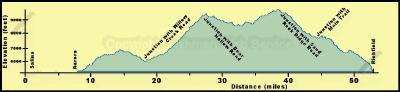
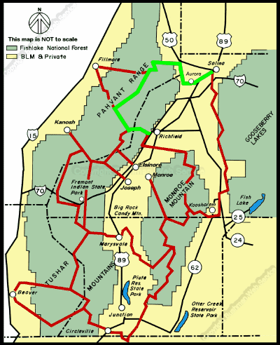
Salina to Richfield
The ride from Salina to Richfield requires about four and three quarters
hours. Within this section the intermediate times are as follows:
Approximate Section Time
· Salina to Aurora -------------------------------------------
0.5 hr
· Aurora to the Willow Creek Road -------------------- 1 hr
· Willow Creek road to Bear Hollow Road ---------- 1 hr
· Bear Hollow Road to Sand Rock Ridge Road----- 1 hr
· Sand Rock Ridge Road to Cottonwood Canyon - 0.25 hr
· Cottonwood to Forest Road 096 --------------------- 0.5 hr
· Junction with main trail to Richfield ------------------ 0.5 hr
From the 5,160-foot elevation at Salina the trail rises slightly then
descends to its lowest elevation of 5,140 feet at the Aurora bridge across
the Sevier River. It then rises to 5,190 feet in Aurora. In the foothills
west of Aurora the trail rises to 6,400 feet on the ridge north of Frogs
Flat and continues up to 6,600 feet at the mouth of Willow Creek Canyon.
From there it climbs to 9,200 feet at the junction with the Bear Hollow
Road near Indian Springs. Across most of the Pahvant Range the trail is
at about 8,800 feet, but then it rises to 9,600 feet at the junction with
the Sand Rock Ridge Road near White Pine Peak, the top of which is about
10,200 feet. From the junction the trail descends to 7,600 feet at the turn
to the Richfield side loop. This loop descends to 6,600 feet at Little Valley
and then about 5,400 feet at Richfield.
continued next page
|
|
|
| |
 |
|
|
| |
|
|
| |
 |
|
| |
 |
|
| |
 |
|
| |
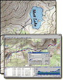
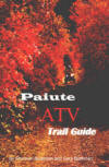
NEW "Paiute
ATV Trail Guide Book". Page
after page of detailed information on the Paiute
ATV Trails. Photos, Maps, GPS Data for every
intersection and point of interest on the trail,
Tip and Tricks for riding the Paiute ATV Trails.
Click Here for More details. |
|
|
|
 |
|
|
|
 |
|
| |
|
|
|
|
Trails Illustrated topographic maps are designed
to take you into the wilderness and back.
Printed on durable tear-resistant, waterproof
material, this map can go virtually anywhere you
do!
Click here for details. |
|
| |
|
|
|
|
Sponsors
Needed |
|
|
|
Your Ad
Can Go Here! |
|
|
|
Contact Us
Click Here
to request
Details. |
|
|
|
Multiple
Website
Advertising
Special. |
|
|
|
Buy 1 Banner
and |
|
|
|
Get Advertising
on Multiple Websites.
for one low single
ad price. |
|
|
|
| |
|