|
| |

The eastern front of an ancient mountain range runs down the center of
today's Pahvant Range. West of this front, the rocks are limestone, quartzite,
sandstone, and shells deposited below sea level in a gradually deepening
ocean basin called a geo syncline. Compressive forces of continental collision
thrust huge sheets of this sedimentary sequence up and over other sheets
to form high mountain ranges. East of this front, the rocks are conglomerates,
sandstone, and shells shed from these ancient mountains and deposited at
their base. Because this debris was deposited on land, much of it is red
and yellow, in contrast to the drab grays and tans of the marine deposits
on the west side of the Pahvant Range.
Shortly after reaching the ridge top, the trail passes the intersection
of the Bear Hollow Road, Forest Road 100, which is the northern leg of the
Fillmore Loop. A comfort station is available here. From the high point
south of the Bear Hollow road southward to White Pine Peak the trail alternates
between open sage meadows and cool groves of aspen, spruce, and fir Since
the ridge top is fairly narrow, there are sweeping panoramas from the meadows.
Here one can see all the mountain ranges traversed by the Paiute ATV Trail.
A short distance south of White Pine Peak the main trail intersects the
southern leg of Fillmore Loop, known as the Sand Rock Ridge Road, Forest
Road 103.
After a sharp turn to the east, the trail enters the valley of Deer Creek.
A good road here makes for easy traveling past open meadows interspersed
with clumps of aspen. Farther down the valley clumps of mountain mahogany,
a wood so dense that it won't float, dot the dry hillsides. Redview Guard
Station, located southwest of the trail, is a remnant of times when travel
was slow and difficult, forcing rangers to remain in the mountains to accomplish
their work.
The reaching of the junction of Forest Road 096 with Forest Road 111
completes the loop of the Paiute ATV Trail. Those going to Richfield continue
on Road 096 to the east. The road into Richfield is smooth in places and
rough in others, in either case, it is very slippery when wet. This side
loop of the Paiute Trail passes beside weirdly sculptured red rocks and
offers fantastic views to the south into Flat Canyon. There is mountain
mahogany on the side slopes and aspen in the bottoms until the trail drops
down into the pinyon and juniper. After crossing Little Valley, the trail
rises to a ridge where there are spectacular views of the Sevier Valley
to the east and Dairy and Flat Canyons to the south. Interlayered red and-white
rocks contrast dramatically with the green vegetation along the Sevier River.
continued next page
|
| |
 |
|
|
| |
|
|
| |
 |
|
| |
 |
|
| |
 |
|
| |
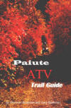
NEW "Paiute
ATV Trail Guide Book". Page
after page of detailed information on the Paiute
ATV Trails. Photos, Maps, GPS Data for every
intersection and point of interest on the trail,
Tip and Tricks for riding the Paiute ATV Trails.
Click Here for More details. |
|
|
|
 |
|
|
|
 |
|
| |
|
|
|
|
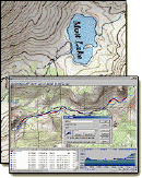
Trails Illustrated topographic maps are designed
to take you into the wilderness and back.
Printed on durable tear-resistant, waterproof
material, this map can go virtually anywhere you
do!
Click here for details. |
|
| |
|
|
|
|
Sponsors
Needed |
|
|
|
Your Ad
Can Go Here! |
|
|
|
Contact Us
Click Here
to request
Details. |
|
|
|
Multiple
Website
Advertising
Special. |
|
|
|
Buy 1 Banner
and |
|
|
|
Get Advertising
on Multiple Websites.
for one low single
ad price. |
|
|
|
| |
|