|
| |
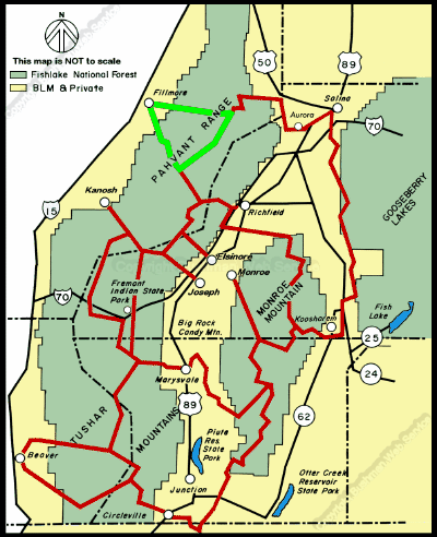
 Filmore Loop #03
The Fillmore Loop is like a giant triangle with the town of Fillmore
at its apex and a portion of the main Paiute Trail as its base. The whole
loop takes three and a half to four hours to ride.
Approximate Section Time
· North Leg -
Chalk Creek and Bear Hollow Road Fillmore to Main Paiute Trail --
1.5 hrs
· East Leg -
Main Paiute Trail Bear Hollow Road to Sand Rock Ridge Road -----
1 hr
· South Leg -
Sand Rock Ridge Road Main Paiute Trail to Fillmore -------------------
1 hr
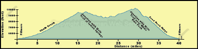
Fillmore is the low point of this loop at 5,150 feet. The north leg of
the loop rises gently along Chalk Creek to 6,400 feet before climbing the
north wall of the canyon to a high point of 9,500 feet and then joining
the main trail at 9,200 feet. The south leg of the loop leaves the main
Paiute Trail at 9,680 feet, rises to a high point of 10,010 feet near White
Pine Peak, and then descends to Fillmore. White Pine Peak itself rises to
10,216 feet.
The north leg of the trail from Fillmore follows paved roads for several
miles to about the Forest boundary. These paved roads can be treacherous
for low-pressure tires and must be driven with extreme caution. At about
the Forest boundary the trail enters the narrow canyon of Chalk Creek, while
the paved road swings onto a bench south of the canyon, the trail follows
an old dirt road that was washed out in the spring floods of 1983. This
road is narrow in places and crosses Chalk Creek several times at undeveloped
crossings, some of which are quite deep. Because of the narrowness of the
canyon there are no camping spots downstream from the picnic grounds.
continued next page
|
| |
 |
|
|
| |
|
|
| |
 |
|
| |
 |
|
| |
 |
|
| |
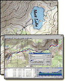
NEW "Paiute
ATV Trail Guide Book". Page
after page of detailed information on the Paiute
ATV Trails. Photos, Maps, GPS Data for every
intersection and point of interest on the trail,
Tip and Tricks for riding the Paiute ATV Trails.
Click Here for More details. |
|
|
|
 |
|
|
|
 |
|
| |
|
|
|
|
Trails Illustrated topographic maps are designed
to take you into the wilderness and back.
Printed on durable tear-resistant, waterproof
material, this map can go virtually anywhere you
do!
Click here for details. |
|
| |
|
|
|
|
Sponsors
Needed |
|
|
|
Your Ad
Can Go Here! |
|
|
|
Contact Us
Click Here
to request
Details. |
|
|
|
Multiple
Website
Advertising
Special. |
|
|
|
Buy 1 Banner
and |
|
|
|
Get Advertising
on Multiple Websites.
for one low single
ad price. |
|
|
|
| |
|