|
| |
| Poison Creek Trail |
-
 The
Poison Creek OHV Route is located in the Escalante District
of the Dixie National Forest just southeast of Antimony
on the John’s Valley Road; Highway 22 will take you
south to Highway 12 & 63, the Bryce Canyon National
Park intersection. As you are leaving Antimony headed
south on the paved John’s Valley Rd, you will come to
a Y intersection before entering into what is known
as Black Canyon. Take a left turn, (east) here on to
a gravel road and stay on this road until it makes a
sharp right turn before a gate to private property.
This road will go to a parking area and continue on
climbing through hills of Pinion Pines and Juniper Trees
on a rather rocky two track road. The
Poison Creek OHV Route is located in the Escalante District
of the Dixie National Forest just southeast of Antimony
on the John’s Valley Road; Highway 22 will take you
south to Highway 12 & 63, the Bryce Canyon National
Park intersection. As you are leaving Antimony headed
south on the paved John’s Valley Rd, you will come to
a Y intersection before entering into what is known
as Black Canyon. Take a left turn, (east) here on to
a gravel road and stay on this road until it makes a
sharp right turn before a gate to private property.
This road will go to a parking area and continue on
climbing through hills of Pinion Pines and Juniper Trees
on a rather rocky two track road.
-
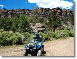
- As the route climbs in altitude, the scenery changes
to huge rounded boulders scattered among cliffs of Quaking
Aspens and then to high open alpine meadows. The route
then splits at which time you may choose to continue
on the Poison Creek route toward the Griffin Top or
venture towards the Otter, Grass, and Trail Lakes routes.
-
-
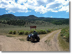
 As
the Poison Creek OHV route continues to climb in altitude
toward the Griffin Top, be sure to stop and look behind
you to take in the overwhelming views of the mountains
and plateaus extending north, west, and south. The route
seems to reach the top and traverses through a sparse
growth of young Quaking Aspens after which you will
need to look for an unsigned two track coming from the
left that heads approximately north to northwest across
an open area. This route will lead to what is called
"Poison Creek Reservoir", which is basically a very
small pond. There should be an old wood sign to the
left of the "Pond" indicating the name of this body
of water. As
the Poison Creek OHV route continues to climb in altitude
toward the Griffin Top, be sure to stop and look behind
you to take in the overwhelming views of the mountains
and plateaus extending north, west, and south. The route
seems to reach the top and traverses through a sparse
growth of young Quaking Aspens after which you will
need to look for an unsigned two track coming from the
left that heads approximately north to northwest across
an open area. This route will lead to what is called
"Poison Creek Reservoir", which is basically a very
small pond. There should be an old wood sign to the
left of the "Pond" indicating the name of this body
of water.
-
- From this point an actual "OHV Trail" begins the
decent back toward Antimony. The decent is quite steep
on loose rocky soil in some areas (not for the novice
rider), through moderately thick stands of aspen that
show the battle scars of Elk Antlers. At some point
the trail traverses along the Poison Creek stream bed,
which in July of 2003 did not have any water running
in it until about half way down the mountain, then the
trail crosses it several times as it descends back into
the Junipers. A lone grouse was spotted so it is assumed
more were hiding in the brush.
-
- At the bottom of this trail, a metal gate leads
on to BLM land for a short distance then enters through
another gate onto private land so please close the gate.
Take an immediate left on a two track that takes you
over to a road past a house and down a gravel road to
another gate. Please be considerate when crossing through
private land! This road intersects with the main gravel
road that will take you back to the beginning of the
Poison Creek OHV Route.
-
- This route is not recommended during winter months
due to deep snow and could be extremely muddy with the
possibility of flash floods during heavy rain events.
Contact the Escalante District Office of the Dixie National
Forest for specific route conditions and map details.
-
- Fuel, Food and Camping are available in the town
of Antimony and the location of some great homemade
pie!
Click here for a downloadable PDF
guide to Poison Creek Trail!
|
|
|
| |
| |
 |
 |
 |
| |
|
|
| |
 |
|
| |
 |
|
| |
 |
|
| |
NEW "Paiute
ATV Trail Guide Book". Page
after page of detailed information on the Paiute
ATV Trails. Photos, Maps, GPS Data for every
intersection and point of interest on the trail,
Tip and Tricks for riding the Paiute ATV Trails.
Click Here for More details. |
|
 |
 |
 |
 |
 |
 |
| |
 |
|
 |
Trails Illustrated topographic maps are designed
to take you into the wilderness and back.
Printed on durable tear-resistant, waterproof
material, this map can go virtually anywhere you
do!
Click here for details. |
 |
| |
|
|
 |
Sponsors
Needed |
 |
 |
Your Ad
Can Go Here! |
 |
 |
Contact Us
Click Here
to request
Details. |
 |
 |
Multiple
Website
Advertising
Special. |
 |
 |
Buy 1 Banner
and |
 |
 |
Get Advertising
on Multiple Websites.
for one low single
ad price. |
 |
|
|
| |
|